
Request a quoteFrom €1,200 excl. VAT

Road and pavement survey: see the layers and the voids before the road gives way.

A road can look intact while the base course is cracked or a void grows beneath it. Before resurfacing, beside a deep excavation or around a drain that keeps sinking, you need the layer thicknesses and the places where the ground has gone.

Belgium and neighbouring regionsReport in EN · FR · NLFrom €1,200 excl. VAT; travel listed separately in the quote
Illustration: our SHRS ground radar on a coned-off road lane, beside a sunken storm drain outlined in paint
Illustration

What we find

Typical depth and the antenna we bring. The ground decides the rest; we say so before quoting.

Road and pavement layers

Layer thickness, sub-base condition and hidden defects.

Typical depth
0 – 1.5 m
Antenna
900 / 400 MHz

Voids and cavities

Settlement voids, washed-out zones, cellars and residual cavities.

Typical depth
0.5 – 6 m
Antenna
400 / 200 MHz

Deep or large targets start with a feasibility test: a short test section decides whether a full survey makes sense.

What you receive

  • Thickness maps of the layers along the section
  • Risk zones outlined on the plan: voids, debonding, settlement
  • Suggested core locations, so the radar readings can be calibrated rather than assumed
  • A report in PDF and DOCX that states what the radar reached and what it did not
Illustration: an asphalt core next to its freshly drilled hole, and a folding ruler
Illustration

The limits, for this kind of survey

01

Thickness needs a velocity

Layer thickness depends on the wave velocity in the pavement; a few cores turn estimates into measurements.

02

Depth of view

A high-frequency antenna sees the layers, not what lies metres down; deeper voids need a low-frequency pass.

03

Wet sub-base

Water in the sub-base absorbs the signal and shortens the reach.

04

Public roads

The client or the road authority arranges the permit and the signage; we work within the agreed traffic arrangement.

Projects of this kind, anonymised

Client names, addresses and locations withheld.

Base-course thickness map of a 90 m road section, with the suspected collapse zone marked
Road · Storm drain

A hidden collapse zone under an intact road surface

Surface intact, no cracks. A 90 m × 6 m section (540 m²) scanned with a 400 MHz 3D radar: cracked base course at about 0.2 m, and a suspected collapse zone 8 m long, its top about 1 m deep, beside a storm drain, with settlement over some 26 m. The radar reached 2.5–3 m, not the culvert below, and the report said so: a deeper low-frequency survey and a camera inspection of the culvert were recommended, and the lane closed in the meantime.
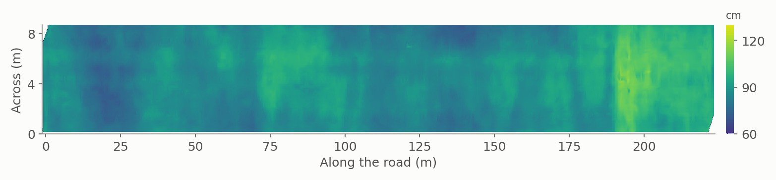
Base-course thickness map along the carriageway, used to place the cores
Road · Pavement condition

Ten cores, placed where the radar pointed

Seven 400 MHz runs over the carriageway, mapped for debonding between layers, cracking, loose zones, voids, settlement and moisture. The maps were used to choose ten core locations, which then checked layer thickness, moisture content and defects — so the radar readings were calibrated, not assumed.

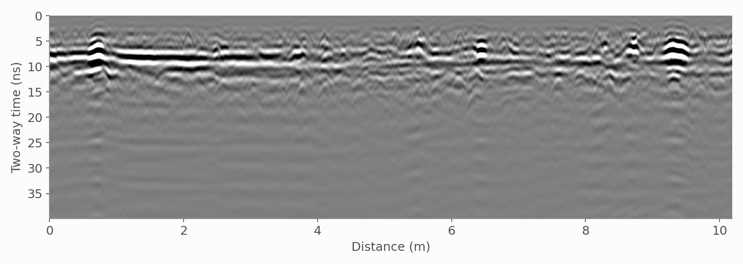
Low-frequency radargram of the road beside the excavation, two-way time axis
Deep excavation · Adjacent road

Screening the road beside a deep excavation

About 200 m × 16 m of road along a building pit, surveyed in two passes, with one view from 0 to 2 m and one down to about 10 m. Suspected risk zones — layer defects, debonding, voids — were outlined for the contractor and checked by core drilling. The plan set a repeat survey after one month, and every 15 days where a risk showed.

In our project log

SiteTaskAntenna · dataStatus
RoadPavement layer assessment with a commercial multichannel array system: layer thickness and moisture400 MHz · multichannelSurveyed
RoadSubsidence and collapse screening around a storm drain400 MHz 3D array · 90 m × 6 mSurveyed
Deep excavationScreening the adjacent roads for voids and debonding, checked by coresLow + high frequency · 2 passesSurveyed

Status: Surveyed — carried out by us on site. Commissioned — ordered by the client, survey still to be carried out.

Budget

From €2,000 excl. VAT for one section; longer roads, several sections and repeat surveys are quoted after a scoping call.

Every quote lists field time, processing, reporting and travel separately.

Request a quote

Tell us the site and the target. An engineer replies within one working day, with a fixed price or a question.

* required

Reply within one working day · no obligation

Or call +32 (0) 491 08 61 09

Plans and photos help: you can send them in reply to our first email.

We use these details only to answer your request. Privacy policy

Frequently asked

Can you find a void before the road collapses?

Often. Voids and washed-out zones change the radar reflection; in one survey a suspected collapse zone 8 m long was found under an intact surface. What lies deeper than the antenna reaches needs a low-frequency pass.

Do we need cores?

They are not required, but they make the layer thicknesses measured rather than estimated. We suggest where they are most useful.

Can you repeat the survey?

Yes. Beside an excavation, a repeat survey shows whether a risk zone grows; the interval is agreed in the quote.

Who arranges signage and permits on public roads?

The client or the road authority arranges the road-works permit and the signage as required. We work within the agreed traffic arrangement, and the quote says what we need from you.